post (POlygon changes in Space and Time) is a package designed to provide array and tabular vector data cube structures to organise and analyse polygons that change their shape in space and time.
post takes two existing packages that support vector data cubes: stars for array vector data cubes and cubble for tabular vector data cubes. It extends their functionality to support changing geometries and to perform spatio-temporal analyses of vector data.
Particularly, post was created to analyse the evolution of geomorphological features such as landslides, lava flows, and glaciers, which change their geometry over time. However, it can be used to analyse other types of moving and/or changing geometries, for example, urban sprawl.
Vector data cubes
Data cubes are multi-dimensional data structures. The most commonly known data cubes, particularly in Earth observation (EO), are raster data cubes. Raster data cubes are structures frequently used to organise time series of satellite imagery, gridded climate data, etc. They have minimum two spatial dimensions: longitude or x and latitude or y. The remainder dimensions can either be time, or other dimension such as bands for EO data.
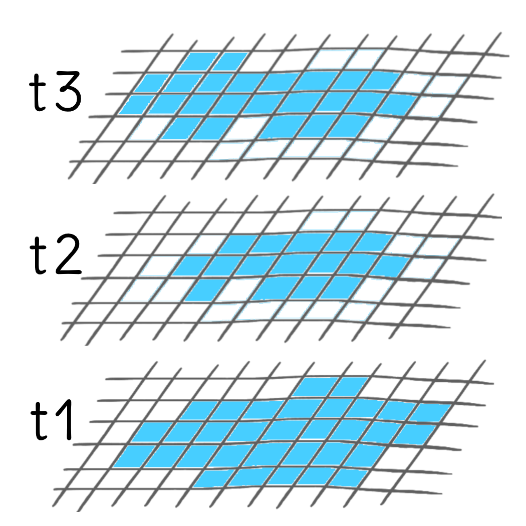
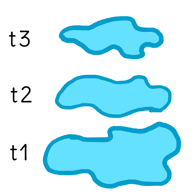
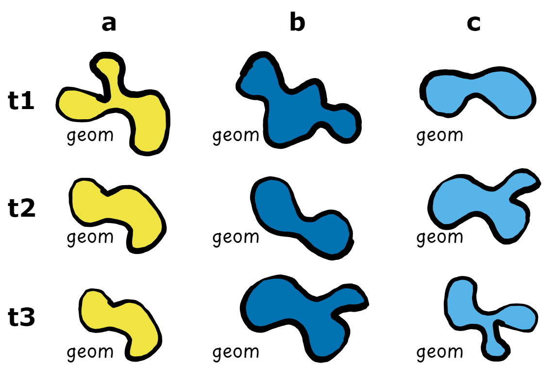
On the other hand, vector data cubes support one minimum spatial dimension, a geometry. Representing data in vector data cubes becomes useful when thematic variables are changing over time at the vector locations, i.e. for spatio-temporal data. For example, time series of temperature, precipitation, wind speed, etc. recorded by climate stations can be represented and analysed using vector data cubes. However, current implementations of vector data cubes only support static geometries (e.g. climate stations stay at the same place over time). post intends to provide support also for geometries that change over time.
Post classes
In R, vector data cube structures are supported in the form of array objects by the stars package and as tabular objects1 with the cubble package. sf is used both by cubble and stars to handle the spatial dimensions. Finally, both stars and cubble support certain tidyverse functions.
post combines the advantages of all these packages to support vector data cubes to structure and analyse polygon geometry time series. For this, two classes are provided: post_array and post_table.
post_array class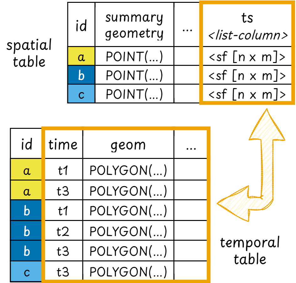
post_table classpost_array inherits the stars class and therefore supports most of stars methods, including the print method.
methods(class = "post_array")
#>  [1] [             as_post_array as_post_table autoplot      filter
#>  [6] mutate        plot          rename        select        slice
#> [11] st_as_sf      st_mask       transmute
#> see '?methods' for accessing help and source code
post_table inherits the cubble class and its subclasses spatial_cubble_df and temporal_cubble_df. Likewise, it supports most of the cubble methods and retains the cubble print methods.
methods(class = "post_table")
#>  [1] arrange            as_post_array      as_post_table      autoplot
#>  [5] dplyr_reconstruct  face_spatial       face_temporal      filter
#>  [9] mutate             plot               rename             select
#> [13] slice              spatial            st_as_sf           st_crs<-
#> [17] st_normalize       st_shift_longitude st_transform       st_wrap_dateline
#> [21] st_zm              unfold
#> see '?methods' for accessing help and source code
Creation and structure
To showcase the data structure of post objects a dummy dataset is provided with the package (?polygons).
polygons
#> Simple feature collection with 25 features and 2 fields
#> Geometry type: POLYGON
#> Dimension:     XY
#> Bounding box:  xmin: -0.2974337 ymin: -0.00297557 xmax: 0.9730806 ymax: 1.153558
#> Geodetic CRS:  WGS 84
#> First 10 features:
#>    gid   datetime                       geometry
#> 1    a 2020-10-01 POLYGON ((0.5474949 0.80889...
#> 2    b 2020-10-01 POLYGON ((0.2791708 0.83373...
#> 3    c 2020-10-01 POLYGON ((0.2807462 0.62779...
#> 4    d 2020-10-01 POLYGON ((0.7650701 0.47444...
#> 5    e 2020-10-01 POLYGON ((0.3825692 0.35378...
#> 6    a 2020-10-02 POLYGON ((0.4961102 0.87283...
#> 7    b 2020-10-02 POLYGON ((0.3298312 0.76120...
#> 8    c 2020-10-02 POLYGON ((0.328914 0.568743...
#> 9    d 2020-10-02 POLYGON ((0.7217233 0.52617...
#> 10   e 2020-10-02 POLYGON ((0.3101455 0.31689...
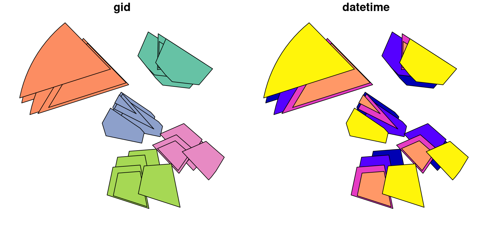
The data has 5 objects with a unique group identifier that changes their shape for different timestamps.
plot(polygons)
To create a post object a group identifier (group_id) is always required2. This identifier should be unique per feature and within each group there should not exist duplicated timestamps.
Minimally, an sf object that is converted to a post object should have the following columns:
- a group identifier
- a timestamp
- changing geometries
When converting an sf object to a post object, the necessary arguments are automatically identified if not supplied.
post_array objects
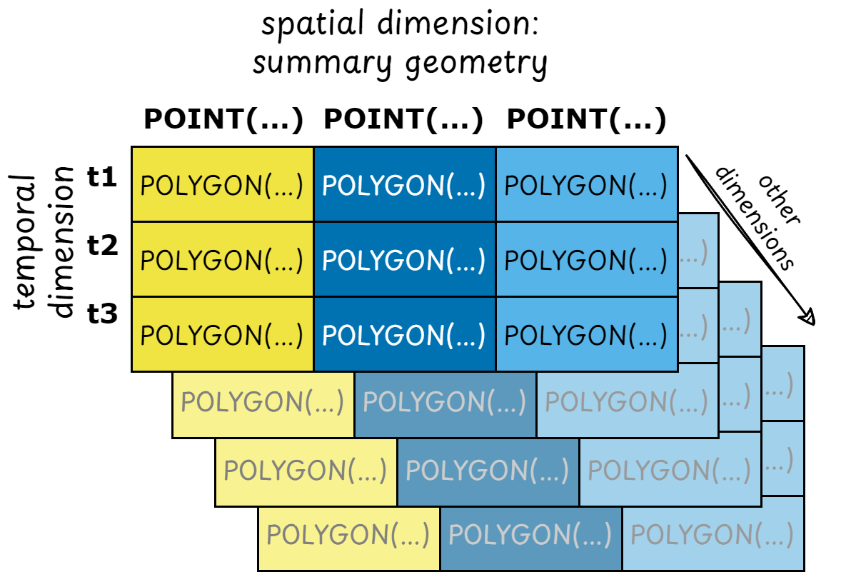
post_array is a spatio-temporal array data structure that organises polygons that change their shape in space and time. It extends the stars class for vector data cubes to support changing geometries as attributes. The post_array class supports two dimensions: a summary geometry dimension (default name: geom_sum) and a temporal dimension. The summary geometry is a unique geometry per group which summarises the changing shapes of the polygon geometries in the group. To learn more about the data structure of post_array objects see vignette("stars4", package = "stars").
Each array “cell” should have a value. In case a particular summary geometry - temporal dimension combination does not exist, the changing geometry is stored as an empty geometry. This behavior guarantees the dimensionality of the post_array object.
(arr = as_post_array(polygons))
#> stars object with 2 dimensions and 1 attribute
#> attribute(s):
#>          geometry
#>  POLYGON      :25
#>  epsg:4326    : 0
#>  +proj=long...: 0
#> dimension(s):
#>          from to     offset  delta refsys point
#> geom_sum    1  5         NA     NA WGS 84  TRUE
#> datetime    1  5 2020-10-01 1 days   Date    NA
#>                                                              values
#> geom_sum POINT (0.6526028 0.901785),...,POINT (0.4718622 0.1952443)
#> datetime                                                       NULL
class(arr)
#> [1] "post_array" "stars"
To extract the summary and changing geometries from post_array objects use:
# changing geometry
arr$geometry
#> Geometry set for 25 features  [dim: 5 x 5]
#> Geometry type: POLYGON
#> Dimension:     XY
#> Bounding box:  xmin: -0.2974337 ymin: -0.00297557 xmax: 0.9730806 ymax: 1.153558
#> Geodetic CRS:  WGS 84
#> First 5 geometries:
#> POLYGON ((0.5474949 0.8088912, 0.4874872 0.8838...
#> POLYGON ((0.2791708 0.8337388, -0.2847997 0.654...
#> POLYGON ((0.2807462 0.6277986, 0.3325024 0.7215...
#> POLYGON ((0.7650701 0.4744459, 0.8787185 0.3753...
#> POLYGON ((0.3825692 0.3537803, 0.5519791 0.3669...
# summary geometry
st_geometry(arr)
#> Geometry set for 5 features
#> Geometry type: POINT
#> Dimension:     XY
#> Bounding box:  xmin: -0.009536052 ymin: 0.1952443 xmax: 0.7627982 ymax: 0.901785
#> Geodetic CRS:  WGS 84
#> POINT (0.6526028 0.901785)
#> POINT (-0.009536052 0.8549277)
#> POINT (0.3932031 0.5571231)
#> POINT (0.7627982 0.3647986)
#> POINT (0.4718622 0.1952443)
The array format does not include the group identifiers in their data structure directly, since they are represented by the summary geometry. However, these identifiers are stored as metadata and can be obtained as:
get_group_ids(arr)
#>   gid
#> 1   a
#> 2   b
#> 3   c
#> 4   d
#> 5   e
post_table objects
post_table is a spatio-temporal tabular data structure that organises polygons that change their shape in space and time. It extends the cubble_df classes for vector data cubes to support changing geometries in the temporal face of the cube. The post_table geometry for the spatial face of the cube defaults to a column named geom_sum, while the changing geometry provided is passed on to the temporal face of the cube. To learn more about the data structure of post_table objects see vignette("cb1class", package = "cubble").
Contrary to post_array objects, post_table can handle gaps in its data, i.e., not every summary geometry - temporal combination should be present.
(tab = as_post_table(polygons))
#> # cubble:   key: gid [5], index: datetime, nested form, [sf]
#> # spatial:  [-0.01, 0.2, 0.76, 0.9], WGS 84
#> # temporal: datetime [date], geometry [POLYGON [°]]
#>   gid       long   lat                 geom_sum ts
#> * <chr>    <dbl> <dbl>              <POINT [°]> <list>
#> 1 a      0.653   0.902     (0.6526028 0.901785) <sf [5 × 2]>
#> 2 b     -0.00954 0.855 (-0.009536052 0.8549277) <sf [5 × 2]>
#> 3 c      0.393   0.557    (0.3932031 0.5571231) <sf [5 × 2]>
#> 4 d      0.763   0.365    (0.7627982 0.3647986) <sf [5 × 2]>
#> 5 e      0.472   0.195    (0.4718622 0.1952443) <sf [5 × 2]>
class(tab)
#> [1] "post_table"        "spatial_cubble_df" "cubble_df"
#> [4] "sf"                "tbl_df"            "tbl"
#> [7] "data.frame"
(tab_temp = face_temporal(tab))
#> # cubble:   key: gid [5], index: datetime, long form
#> # temporal: 2020-10-01 -- 2020-10-05 [1D], no gaps
#> # spatial:  long [dbl], lat [dbl], geom_sum [POINT [°]]
#>    gid   datetime                                                       geometry
#>  * <chr> <date>                                                    <POLYGON [°]>
#>  1 a     2020-10-01 ((0.5474949 0.8088912, 0.4874872 0.8838477, 0.5520055 1.032…
#>  2 a     2020-10-02 ((0.4961102 0.8728385, 0.4361026 0.947795, 0.5006209 1.0966…
#>  3 a     2020-10-03 ((0.5578801 0.8616378, 0.5623908 1.085448, 0.8520717 0.8981…
#>  4 a     2020-10-04 ((0.5652241 0.872057, 0.5685463 1.036898, 0.7819022 0.89897…
#>  5 a     2020-10-05 ((0.6063791 0.8304178, 0.5463715 0.9053744, 0.6108898 1.054…
#>  6 b     2020-10-01 ((0.2791708 0.8337388, -0.2847997 0.6540191, -0.2825181 0.6…
#>  7 b     2020-10-02 ((0.3298312 0.7612067, -0.2341393 0.5814869, -0.2318577 0.5…
#>  8 b     2020-10-03 ((0.3796448 0.767853, -0.1843257 0.5881332, 0.09777458 1.05…
#>  9 b     2020-10-04 ((0.3642467 0.779727, -0.1182199 0.6259799, 0.1231118 1.026…
#> 10 b     2020-10-05 ((0.2665368 0.8649996, -0.2974337 0.6852798, -0.2951521 0.6…
#> # ℹ 15 more rows
class(tab_temp)
#> [1] "post_table"         "temporal_cubble_df" "cubble_df"
#> [4] "sf"                 "tbl_df"             "tbl"
#> [7] "data.frame"
To extract the summary and changing geometries from post_table objects use:
# changing geometry
st_geometry(tab)
#> Geometry set for 5 features
#> Geometry type: POINT
#> Dimension:     XY
#> Bounding box:  xmin: -0.009536052 ymin: 0.1952443 xmax: 0.7627982 ymax: 0.901785
#> Geodetic CRS:  WGS 84
#> POINT (0.6526028 0.901785)
#> POINT (-0.009536052 0.8549277)
#> POINT (0.3932031 0.5571231)
#> POINT (0.7627982 0.3647986)
#> POINT (0.4718622 0.1952443)
# summary geometry
st_geometry(tab_temp)
#> Geometry set for 25 features
#> Geometry type: POLYGON
#> Dimension:     XY
#> Bounding box:  xmin: -0.2974337 ymin: -0.00297557 xmax: 0.9730806 ymax: 1.153558
#> Geodetic CRS:  WGS 84
#> First 5 geometries:
#> POLYGON ((0.5474949 0.8088912, 0.4874872 0.8838...
#> POLYGON ((0.4961102 0.8728385, 0.4361026 0.9477...
#> POLYGON ((0.5578801 0.8616378, 0.5623908 1.0854...
#> POLYGON ((0.5652241 0.872057, 0.5685463 1.03689...
#> POLYGON ((0.6063791 0.8304178, 0.5463715 0.9053...
Conversion between post_* objects
The functions as_post_*() can be used to convert objects between from post_table to post_array and viceversa. This is particularly useful when certain methods and operations are only available for one class.
tab |> as_post_array()
#> stars object with 2 dimensions and 1 attribute
#> attribute(s):
#>          geometry
#>  POLYGON      :25
#>  epsg:4326    : 0
#>  +proj=long...: 0
#> dimension(s):
#>          from to     offset  delta refsys point
#> geom_sum    1  5         NA     NA WGS 84  TRUE
#> datetime    1  5 2020-10-01 1 days   Date    NA
#>                                                              values
#> geom_sum POINT (0.6526028 0.901785),...,POINT (0.4718622 0.1952443)
#> datetime                                                       NULL
arr |> as_post_table()
#> # cubble:   key: gid [5], index: datetime, nested form, [sf]
#> # spatial:  [-0.01, 0.2, 0.76, 0.9], WGS 84
#> # temporal: datetime [date], geometry [POLYGON [°]]
#>   gid       long   lat                 geom_sum ts
#> * <chr>    <dbl> <dbl>              <POINT [°]> <list>
#> 1 a      0.653   0.902     (0.6526028 0.901785) <sf [5 × 2]>
#> 2 b     -0.00954 0.855 (-0.009536052 0.8549277) <sf [5 × 2]>
#> 3 c      0.393   0.557    (0.3932031 0.5571231) <sf [5 × 2]>
#> 4 d      0.763   0.365    (0.7627982 0.3647986) <sf [5 × 2]>
#> 5 e      0.472   0.195    (0.4718622 0.1952443) <sf [5 × 2]>
For a conversion from post_array to post_table the argument drop_empty is available in case the post_array object has empty geometries. Dropping empty geometries is the default.
set.seed(732)
(arr_empty = polygons[sample(nrow(polygons), 13), ] |>
  as_post_array())
#> stars object with 2 dimensions and 1 attribute
#> attribute(s):
#>          geometry
#>  POLYGON      :25
#>  epsg:4326    : 0
#>  +proj=long...: 0
#> dimension(s):
#>          from to     offset  delta refsys point
#> geom_sum    1  5         NA     NA WGS 84  TRUE
#> datetime    1  5 2020-10-01 1 days   Date    NA
#>                                                               values
#> geom_sum POINT (0.6454728 0.8842442),...,POINT (0.4759192 0.1771352)
#> datetime                                                        NULL
arr_empty$geometry
#> Geometry set for 25 features  (with 12 geometries empty) [dim: 5 x 5]
#> Geometry type: POLYGON
#> Dimension:     XY
#> Bounding box:  xmin: -0.2847997 ymin: -0.00297557 xmax: 0.8416864 ymax: 1.122298
#> Geodetic CRS:  WGS 84
#> First 5 geometries:
#> POLYGON ((0.5474949 0.8088912, 0.4874872 0.8838...
#> POLYGON ((0.2791708 0.8337388, -0.2847997 0.654...
#> POLYGON EMPTY
#> POLYGON EMPTY
#> POLYGON ((0.3825692 0.3537803, 0.5519791 0.3669...

# converting to post_table
as_post_table(arr_empty) |>
  face_temporal()
#> # cubble:   key: gid [5], index: datetime, long form
#> # temporal: 2020-10-01 -- 2020-10-05 [1D], has gaps!
#> # spatial:  long [dbl], lat [dbl], geom_sum [POINT [°]]
#>    gid   datetime                                                       geometry
#>  * <chr> <date>                                                    <POLYGON [°]>
#>  1 a     2020-10-01 ((0.5474949 0.8088912, 0.4874872 0.8838477, 0.5520055 1.032…
#>  2 a     2020-10-04 ((0.5652241 0.872057, 0.5685463 1.036898, 0.7819022 0.89897…
#>  3 b     2020-10-01 ((0.2791708 0.8337388, -0.2847997 0.6540191, -0.2825181 0.6…
#>  4 b     2020-10-02 ((0.3298312 0.7612067, -0.2341393 0.5814869, -0.2318577 0.5…
#>  5 b     2020-10-03 ((0.3796448 0.767853, -0.1843257 0.5881332, 0.09777458 1.05…
#>  6 c     2020-10-02 ((0.328914 0.5687438, 0.3806701 0.6624509, 0.5646669 0.5374…
#>  7 c     2020-10-03 ((0.2897647 0.6168588, 0.3415208 0.710566, 0.5357965 0.4922…
#>  8 c     2020-10-04 ((0.2930046 0.6546896, 0.3210764 0.7055149, 0.4264484 0.587…
#>  9 c     2020-10-05 ((0.2145846 0.5285578, 0.2663408 0.6222649, 0.4503375 0.497…
#> 10 d     2020-10-02 ((0.7217233 0.5261787, 0.8353717 0.4270488, 0.7832953 0.340…
#> 11 e     2020-10-01 ((0.3825692 0.3537803, 0.5519791 0.3669884, 0.6063218 0.096…
#> 12 e     2020-10-03 ((0.2813385 0.2544898, 0.4507484 0.2676979, 0.505091 -0.002…
#> 13 e     2020-10-05 ((0.4750757 0.2620892, 0.6444856 0.2752973, 0.6988282 0.004…
as_post_table(arr_empty, drop_empty = FALSE) |>
  face_temporal()
#> # cubble:   key: gid [5], index: datetime, long form
#> # temporal: 2020-10-01 -- 2020-10-05 [1D], no gaps
#> # spatial:  long [dbl], lat [dbl], geom_sum [POINT [°]]
#>    gid   datetime                                                       geometry
#>  * <chr> <date>                                                    <POLYGON [°]>
#>  1 a     2020-10-01 ((0.5474949 0.8088912, 0.4874872 0.8838477, 0.5520055 1.032…
#>  2 a     2020-10-02                                                        EMPTY
#>  3 a     2020-10-03                                                        EMPTY
#>  4 a     2020-10-04 ((0.5652241 0.872057, 0.5685463 1.036898, 0.7819022 0.89897…
#>  5 a     2020-10-05                                                        EMPTY
#>  6 b     2020-10-01 ((0.2791708 0.8337388, -0.2847997 0.6540191, -0.2825181 0.6…
#>  7 b     2020-10-02 ((0.3298312 0.7612067, -0.2341393 0.5814869, -0.2318577 0.5…
#>  8 b     2020-10-03 ((0.3796448 0.767853, -0.1843257 0.5881332, 0.09777458 1.05…
#>  9 b     2020-10-04                                                        EMPTY
#> 10 b     2020-10-05                                                        EMPTY
#> # ℹ 15 more rows
Visualisation
Autoplot
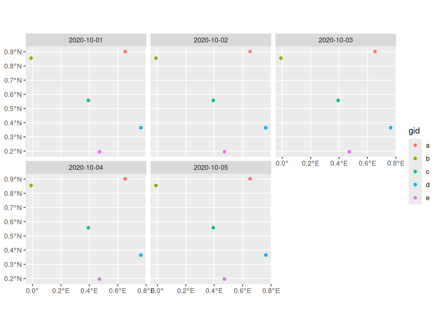
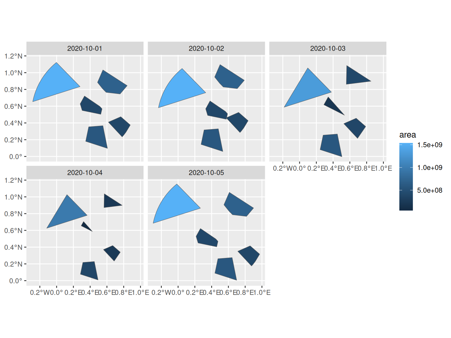
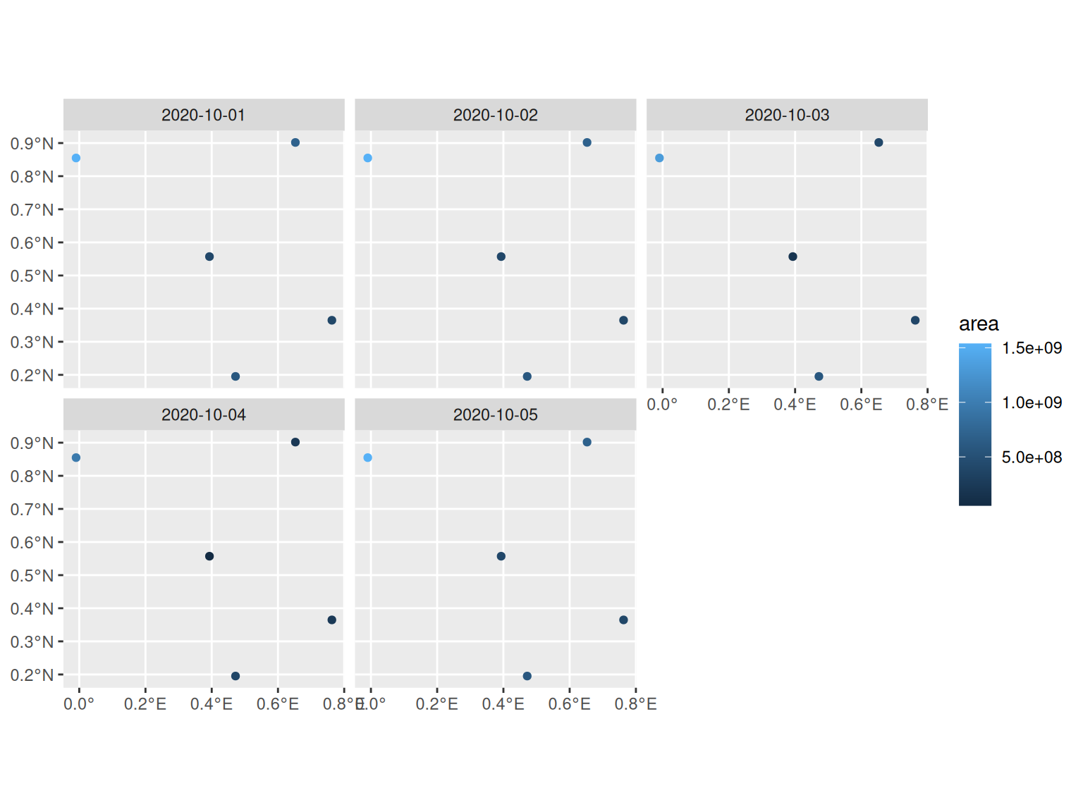
For a quick visualisation of the post objects, you can use ggplot2::autoplot(). The plot will show individual facets according to the first non-spatial dimension for post_array objects and according to the time column for post_table objects.
You can choose between visualising the attributes based on the summary or changing geometries.
Base R plot
If you don’t have ggplot2 installed, for post_array objects, the default plot.stars method is supported as well when the post_array object has non-spatial attributes. The geometry plotted is the summary geometry.
plot(arr)
For post_table objects, the plot method (which defaults to plot.sf()) applied to the spatial face shows the summary geometry attributes, while the temporal face shows the changing geometries and its attributes.
If there are any attributes in the spatial face that you would like to see on the temporal face plot, you can unfold them.
tab |>
  face_temporal() |>
  unfold("lat", "long") |>
  plot()
Customised plotting
If you want to achieve more complex visualisations, or just use another package of your choice, you can extract the data as an sf object from post_array and post_table objects and achieve this. Internally, this is what post is doing as well.
arr = as_post_array(polygons, geometry_summary = summarise_geometry_union)
arr$area = st_area(arr$geometry)
arr$logical = sample(c(rep(TRUE, 20), rep(FALSE, 20)), 25, replace = F)
(arr_sf = st_as_sf(arr))
#> Simple feature collection with 25 features and 4 fields
#> Active geometry column: geometry
#> Geometry type: POLYGON
#> Dimension:     XY
#> Bounding box:  xmin: -0.2974337 ymin: -0.00297557 xmax: 0.9730806 ymax: 1.153558
#> Geodetic CRS:  WGS 84
#> # A tibble: 25 × 6
#>    gid          area logical                                 geom_sum datetime
#>    <chr>       <dbl> <lgl>                              <POLYGON [°]> <date>
#>  1 a      693272313. TRUE    ((0.4971355 0.8717961, 0.5474949 0.8088… 2020-10-01
#>  2 a      693260956. TRUE    ((0.4971355 0.8717961, 0.5474949 0.8088… 2020-10-02
#>  3 a      405985931. TRUE    ((0.4971355 0.8717961, 0.5474949 0.8088… 2020-10-03
#>  4 a      220231724. FALSE   ((0.4971355 0.8717961, 0.5474949 0.8088… 2020-10-04
#>  5 a      693268587. TRUE    ((0.4971355 0.8717961, 0.5474949 0.8088… 2020-10-05
#>  6 b     1537008395. TRUE    ((-0.1774445 0.5995572, -0.1843257 0.58… 2020-10-01
#>  7 b     1537040160. FALSE   ((-0.1774445 0.5995572, -0.1843257 0.58… 2020-10-02
#>  8 b     1319132956. FALSE   ((-0.1774445 0.5995572, -0.1843257 0.58… 2020-10-03
#>  9 b      965402936. FALSE   ((-0.1774445 0.5995572, -0.1843257 0.58… 2020-10-04
#> 10 b     1536993945. FALSE   ((-0.1774445 0.5995572, -0.1843257 0.58… 2020-10-05
#> # ℹ 15 more rows
#> # ℹ 1 more variable: geometry <POLYGON [°]>
Note that the object has two geometry list-columns. Only one of them is active, defaulting to the changing geometries.
attr(arr_sf, "sf_column")
#> [1] "geometry"
You could for example want to add the summary geometry as background to identify easily how the geometries have changed over time, in comparison to their union. For that you can create a new object with the summary geometry active.
arr_sum = st_set_geometry(arr_sf, "geom_sum")With that you can use more customised plotting with, for example, ggplot2 to create nice maps of your data.
ggplot(arr_sf) +
  geom_sf(data = arr_sum, fill = "grey80", color = NA) +
  geom_sf(aes(fill = area, color = logical), linewidth = 0.3) +
  scale_fill_viridis_c() +
  scale_color_manual(values = c("black", "red")) +
  facet_grid(rows = vars(gid), cols = vars(datetime)) +
  theme_bw()

